Big Cypress National Preserve is a 729,000 acre swamp in South Florida adjacent to Everglades National Park. It was originally going to be part of that, but instead was established as a national preserve in 1974.
I’ve wanted to visit for years and finally went down a couple of weeks ago. I stayed at the bungalow Clyde Butcher rents behind his Big Cypress Gallery along Tamiami Trail. This is a “first impressions” blog post, not a guide. I don’t know the area well enough to give you a comprehensive review.
 Butcher’s Pond. Next to Clyde Butcher’s gallery on Tamiami Trail
The bungalow was very nice and provided a good base for exploration. I do wish there was cell service or that they provided an internet connection – although I guess you could argue that being cut off is part of the swamp experience!
Big Cypress is huge and there are a lot of places to check out. And even more places if you include Everglades National Park. For me, the southern portion of the Everglades was just too far away from where I stayed so I concentrated on nearby spots including Kirby Storter Park, Fakahatchee Strand, Loop Road, Shark Valley, and a few others. There was a lot I didn’t get to – I need to go back!
 Pre-dawn stars and clouds, Kirby Storter Roadside Park
Kirby Storter was only a few minutes away and I hoped to take advantage of dark skies and catch site of the Milky Way from there. I did manage to glimpse it but clouds rolled in towards dawn and I had to make do with a starry pre-dawn photo instead. I can tell you that I felt very alone out there in the middle of the swamp at 5am. It was dark (no moon) and hard to see very far – kinda spooky. But I also felt pretty safe because every time I moved a bit, the crickets went silent. I figured they’d warn me if anything large got close!
 Cypress swamp, Kirby Storter Roadside Park
There’s a lovely, short hike along a boardwalk that leads back into the swamp next to some flowing water and ends at a large gator hole.
 Red-shouldered Hawk Pair. Fakahatchee Strand State Park
Fakahatchee Strand Preserve State Park was close too. It’s the largest state park in Florida and Janes Memorial Scenic Drive is an eleven mile dirt road leading from the visitor center back into the swamp. There’s only about six miles open right now due to damage from Hurricane Irma. You can drive this yourself like I did, or take a guided tram ride.
I was busy trying to make landscape photos when a lady hawk (the one on the left) started calling in the tree next to me. I thought she was yelling at me for being too close, but it turned out she was calling for her mate. He flew in and they had a “conjugal visit” while I rushed back to the car to get my longer lens. I missed the action, but did get a nice family photo of the pair afterward.
 Fakahatchee Strand 4, color
There are a great many views of this lovely swamp along the scenic drive. It took me a long time to go out six miles and back because I stopped so often to photograph.
 Loop Road Cypress and Sawgrass
Loop Road is another scenic area. Both ends connect to Tamiami Trail and I explored those, but didn’t travel the whole twenty six mile route. Next time!
On my visit, I mainly focused on landscape images although I did see and photograph some wildlife – mainly in Shark Valley. There were alligators, turtles, and a lot of birds – most were the same ones we see up here in Central Florida although I did sight a yellow crowned night Heron which isn’t very common in my usual spots. There were also a lot of small birds / warblers that I should have spent some time photographing / identifying.
This was a good time of year to visit. It’s considered the “dry season” and in additon to the comfortable temperatures, I got zero bug bites even though I didn’t use any bug spray the whole time.
You could spend a lifetime exploring there. I stayed for three nights and was very tired when I got home but only touched the surface. Things I wanted to do but didn’t have time for: Big Cypress Bend Boardwalk, Corkscrew Swamp, a swamp buggy tour, a swamp walk, an airboat ride, the Indian reservations and many others. Things to look forward to!
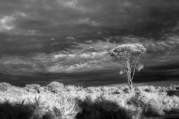
 Cypress and air plants, IR B&W
Location scouting is a huge part of good landscape photography. Sometimes you don’t have the luxury of scouting in advance. You know that an area is special when you can come back from your first visit with photos you really like. Big Cypress is extra special – a Central Florida Photo Ops Must Do!
We should all be grateful that we’ve preserved places like Big Cypress and the Everglades and that we’re working to restore them to their natural state.
Two other blog posts about this trip:
A previous post about the Everglades:
Related Flick Albums:
Thanks for stopping by and reading my blog. Now – go make some photos!
©2020, Ed Rosack. All rights reserved

 The water is wide
 Rays and reflection
 Youngster – This juvenile Green Heron has fledged and is out in the world fending for itself
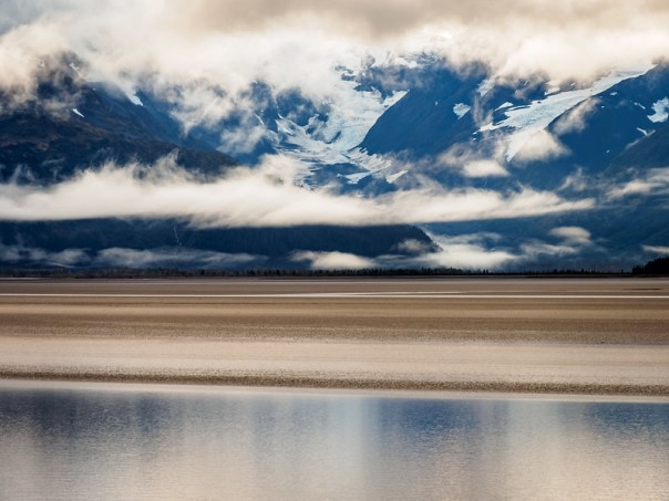
 Pines and palmettos