
Here comes the sun – Sunrays shining through offshore clouds mirrored on calm inshore water. Merritt Island National Wildlife Refuge. GPS: 28°38’8″ N 80°46’33” W
I’ve been adding Lat/Lon location info to my photos for several years. It’s helpful to others to see where I made each one. And I like to look back and see the info too. If you click on a photo in the blog that I’ve geo-tagged, it’ll display on Flickr with a map showing the location below the photo.
I use Lightroom’s Map module for this. If I know where I was I can easily drag the photos to that place on the map. For unfamiliar places, I try to remember to make at least one iPhone photo so I can copy its GPS info to the other photos I make there. That’s what I did on my recent trip to Acadia National Park and it worked well. But I want something a bit less manual.
It would be nice if all cameras did this automagically like the iPhone does. The only other one I have with GPS capability is an Olympus TG-2 underwater camera that I use when kayaking. Nikon makes an add-on GPS, but it only works with Nikon, you’d have to remember it, not lose it, and it plugs into the remote release socket – so it’s a pain when you’re shooting from a tripod.
I’ve experimented before with using my phone to record GPS tracks. On our trip to Alaska in 2009, I used an app and later synced the tracks to photos back on my computer. That was a pain too (the app and software weren’t very reliable). But it seems I wasn’t paying attention to Lightroom updates since then. I completely missed that it now has the capability to sync a captured GPX format track to photos in your library.

Lightroom Map Module: The track interface is hidden in a pull down menu at the bottom of the screen.
Using the interface at the bottom of the Map Module (shown above), you can load a track and use it to auto-tag the location of photos in a folder. And it works very well!
So how exactly do you do this? There are three steps:
- Before you leave, make sure you set the time in your cameras correctly. The time stamp is used to sync the position from the GPS track to each photo.
- Use your GPS unit or an app on your phone to record a track of your movements. There are several iPhone apps that will capture the track info. I tried GeoTagr ($4.99 in the app store) and it worked well. Motion-X GPS (no longer in the app store?) also works. When I got back home, I emailed myself the .gpx file with the track information. One warning: sometimes these location recording apps can be power hungry. You might want to check to make sure you don’t run down your battery doing this.
- Move the .gpx track file to the folder on your computer with your photos. Then load it into Lightroom and apply it to the photos. Easy-peasy! It all just works!
Two more geo-tagged photos from a quick trip to Merritt Island early last Thursday:
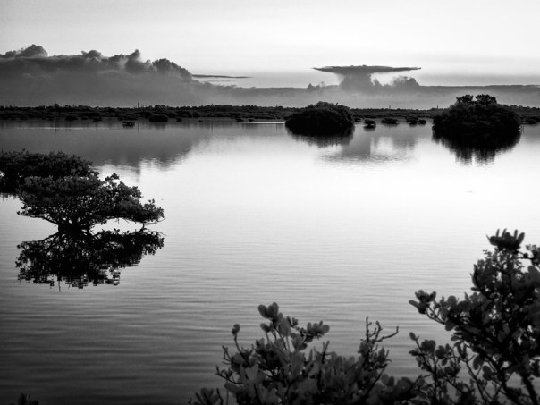
Nearby Mangroves and distant storm. Merritt Island National Wildlife Refuge. GPS: 28°38’8″ N 80°46’33” W

Morning by the causeway. Parrish Park. GPS: 28°37’21” N 80°47’45” W
I like this method and I’ll probably use it in the future. It’s much less fussy than what I tried several years ago. Now all I have to do is remember to start the app at the beginning of a photo-op. I wish I’d worked this out before my trip to Maine. It was an effort to figure out where each of those photos were made.
By the way, MINWR was still quiet last week – not much wildlife or birds about. I did see a group of White Pelicans there. Usually, they don’t show up until November. I’m not sure what that means, but they were fun to watch.
Thanks for stopping by and reading my blog. Now, go make some photos! And geo-tag them!
©2014, Ed Rosack. All rights reserved.
Well explained! It’s great the way you work out how to do things, and kind that you bother to share.
And you Rhona, are very kind to leave such nice comments – thank you!
I agree with Rhona…Thank you for sharing this great idea! Now, I just have to do it!
You’re very welcome, Dorothy. It’s actually pretty easy, especially if you use Lightroom. If you don’t use Lightroom, the GeoTagr app I mention can do the geo tagging all by itself. They have instructions on their web site.